Put Your Well Exactly Where the Reservoir Is. Every Time.
Albatik is the authorized Libyan representative of ROGII delivering StarSteer, one of the world’s leading real-time geosteering and well placement platforms, to Libya’s drilling operations with round-the-clock local technical support.
The Service.
Every meter drilled outside the target formation is cost without production. Real-time geosteering placing directional wells precisely within target reservoir intervals as they are drilled, is one of the highest-return technical investments a drilling program can make. Albatik brings this capability to Libya through our partnership with ROGII.
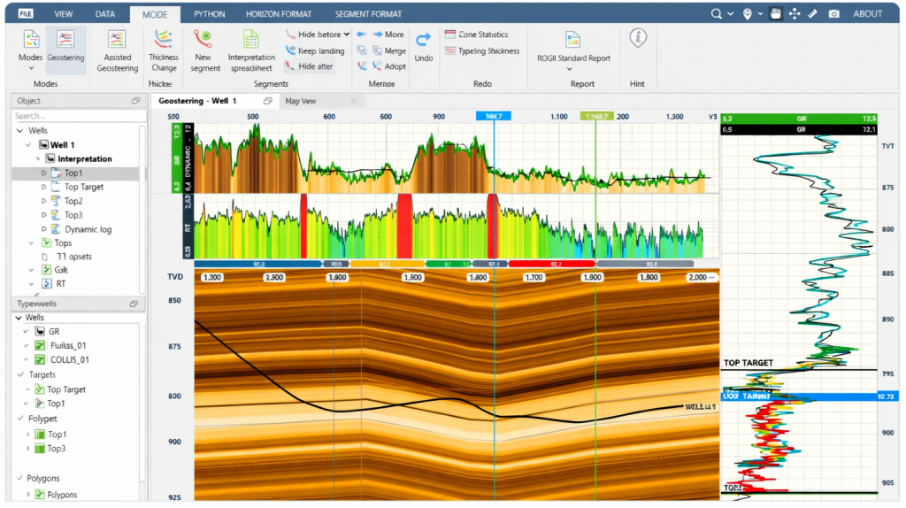
StarSteer integrates real-time LWD data, resistivity inversion, 3D geological modelling, and machine-learning-assisted auto-steering into a single, cloud-connected platform. Albatik’s geosteering engineers monitor operations remotely and in real time, communicating continuously with on-site drilling teams to keep every well on target — and every geological surprise managed as it happens, not after the bit has passed.
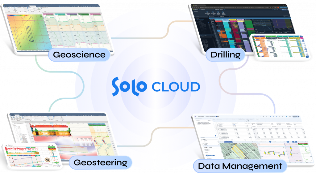
The Platform — StarSteer, Solo Cloud & DrillSpot
StarSteer is deployed by more than 400 client organizations worldwide and is used on most lateral wells drilled globally, across every major conventional and unconventional basin. Its cloud backbone, Solo Cloud, keeps geological models updating in real time as the bit advances, so the geosteering engineer, the operations geologist, and the rig-site team always share the most current picture of the formation. DrillSpot extends the same environment into real-time drilling monitoring and optimisation, integrating drilling dynamics with geology on a single screen, while StarLite puts live well monitoring on any phone or tablet.
What We Deliver
- 24/7 remote real-time geosteering from our operations center
- StarSteer platform deployment, licensing, and operator training
- LWD data acquisition, quality control, and real-time interpretation
- Resistivity inversion modelling for formation boundary detection
- 3D geomodeling construction and continuous update via Solo Cloud
- Directional drilling program design and optimization
- Real-time drilling monitoring and analytics with DrillSpot
- Post-well analysis and lessons-learned reporting